How to Search Quebec Mining Claims (GESTIM) and Map Them
To map Quebec mining claims, open Exploration Maps, choose Add Claims → Search Claims Registry, select Quebec, and type a titleholder (company) name or claim number. The results come from Quebec's public GESTIM titres miniers dataset, which is a refreshed public extract (not a live query), so it can lag the official registry. Always verify current title status and boundaries in GESTIM before relying on the map.
Quebec mineral tenure overview
Quebec mining claims (titres miniers) are administered by the Ministère des Ressources naturelles et des Forêts (MRNF) through GESTIM Plus. Quebec is a tier-one jurisdiction: the Abitibi greenstone belt hosts world-class gold and base-metal deposits such as Canadian Malartic and LaRonde, and the James Bay region is Canada's fastest-growing lithium and critical-minerals district. The map-designation claim (claim désigné sur carte) is the dominant exploration tenure.
Important: Quebec uses a refreshed dataset, not a live query
Quebec is handled differently from provinces queried live. GESTIM's portal is login-gated and SIGÉOM serves map images only, but Quebec publishes its complete active-titles dataset as a public file. Exploration Maps loads that refreshed public extract and searches it by company or claim number — no login required. Because it's a periodic refresh, it can lag very recent staking or expiries, so treat it as a planning aid and confirm specifics in GESTIM.
Step 1: Select Quebec in registry search
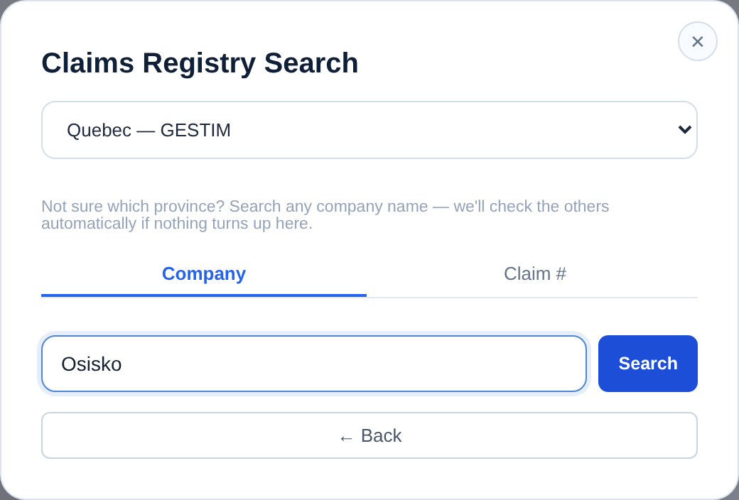
Choose Add Claims → Search Claims Registry and select Quebec — GESTIM. Two tabs are available: Company (titleholder / titulaire name) and Claim # (an exact title number such as 2654321).
Step 2: Search by titleholder or claim number
Type a company name such as 'Osisko', 'Patriot Battery Metals', or 'Les métaux Niobay' — accented French names are supported. The Company tab matches the registered titleholder; the Claim # tab looks up an exact title number. Results cover active titles across Abitibi, James Bay, Nunavik, and the Laurentides.
Step 3: Add claims and assign the Claims role
Select the geographic groups that match your project and click Add to map. The polygons load reprojected to WGS84 and styled for presentations; assign the Claims role for the standard convention and rename layers if you're comparing operators.
Step 4: Add context and export
Choose a basemap (Terrain suits Abitibi-belt ground), enable Context and Reference Labels, add your title block and logo, and export PNG for slides or PDF for reports. A 2–3× PDF export meets typical figure standards. Free PNG exports retain a small Exploration Maps credit. Pro removes that credit for US$29/month or US$290/year.
Example: a James Bay lithium land position
To show a peer's James Bay lithium position, search their titleholder name, select Quebec, add the James Bay group, assign the Claims role, switch to Satellite, add a title block and date, and export Landscape 16:9. Because Quebec is a refreshed dataset, double-check any very recent claims against GESTIM before you publish.
Verify in GESTIM
What the app can and can't verify
Cannot: reflect changes since the last refresh, or confirm legal ownership, good-standing, or survey-grade boundaries. Confirm specifics in GESTIM.
Related guides
See the broad mining claims map guide, compare with Ontario or British Columbia, import your own files with the GeoJSON / Shapefile guide, and finish with the professional map guide. Once the titres are on the map, the mining map software handles layout and export, and the drill results map adds collars and intercepts for a news release. For BC and Ontario issuers, browse the claim maps by company.