How to Search Ontario Mining Claims and Map Them
To search Ontario mining claims, open Exploration Maps, choose Add Claims → Search Claims Registry, select Ontario, type a company or claim-holder name (or a claim number), pick your claim groups, and click Add to map. Assign the Claims role, style, and export. Always confirm current holder, status, and boundaries in the official Ontario MLAS before relying on the map.
What is the Ontario MLAS?
The Ontario Mineral Lands Administration System (MLAS) is the provincial registry for mining claims, leases, and other mineral dispositions, administered by the Ontario Ministry of Mines. It covers the whole province, with active exploration concentrated in the Abitibi Greenstone Belt, Timmins–Kirkland Lake, and the Sudbury area. Exploration Maps uses public MLAS claim data so you can map tenure without downloading shapefiles.
Already have your claim boundaries?
Upload your GeoJSON, KML/KMZ or zipped shapefile instead of searching the registry again. Add separate files for your project and neighbouring ground, then give each layer a clear name.
- Upload your claim file and choose the Claims role.
- In the first-map checklist, choose Use investor layout · 16:9.
- Set the title and date, check the legend, then Export PNG. Free PNGs retain an Exploration Maps credit.
- Save to a free account to keep working on the map later.
From a claim file to a presentation layout
These screenshots show an illustrative boundary imported into the actual editor, followed by the investor layout. The example geometry is for the walkthrough and is not an official claim record.
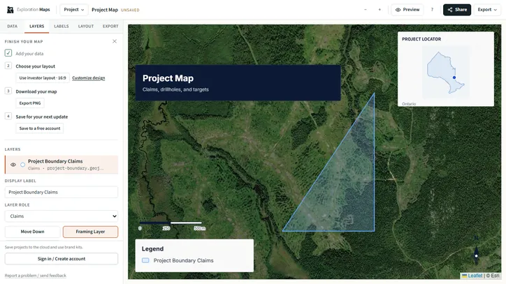
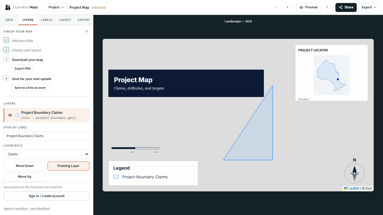
Step 1: Open the claims registry search for Ontario
From the landing page choose Add Claims → Search Claims Registry, or open '+ Add Claims' in the editor sidebar. Select Ontario — MLAS from the province dropdown.
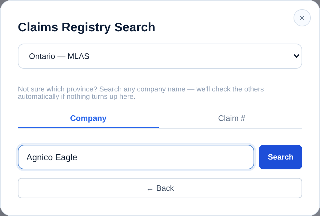
Step 2: Search by company name or claim number
Type a company or individual holder name — e.g. 'Alamos Gold' or 'Agnico Eagle' — in the Company tab and press Enter, or switch to the Claim # tab for a specific Ontario claim number. Results are grouped by geographic cluster (Kirkland Lake, Timmins, Thunder Bay) so you can pick the right tenure package quickly.
Step 3: Add the claims and assign the Claims role
Check the groups you want — the summary shows total claim count and area in hectares — then click Add to map. The claims load as a polygon layer, and assigning the Claims role applies the standard blue styling used in NI 43-101 figures. Rename layers if you're showing more than one operator.
Step 4: Style, add context, and export
Adjust colour, opacity, and border weight in the layer card, enable roads and reference labels for context, choose a basemap, add your title block and logo, then export PNG for slides or PDF for reports. Free PNG exports retain a small Exploration Maps credit. Pro removes that credit for US$29/month or US$290/year.
Example: mapping an operator's Abitibi ground
To brief your team on a competitor's position in the Abitibi, search the company name, select Ontario, add the Timmins and Kirkland Lake groups, assign the Claims role, switch to Satellite to show the greenstone terrain, add a title block and date, and export Landscape 16:9 — a clean competitive-position map in a few minutes.
If an Ontario owner search is empty
Try one distinctive word from the holder name, or the subsidiary listed on the claim. If you have a claim number, use Claim # instead. Verify the record in MLAS; an empty name match is not evidence that the ground is unheld.
Verify in Ontario MLAS
Where the data comes from
What the app can and can't verify
Cannot: confirm legal ownership, good-standing, assessment-work compliance, or survey-grade boundaries. Confirm specifics in MLAS.
Related guides
See the broad mining claims map guide, compare with British Columbia or Quebec, import your own files with the GeoJSON / Shapefile guide, and finish with the professional map guide. For worked examples, browse the Ontario company claim maps.