Search published mineral claim records by registered holder, review the candidate titles, and map the ones relevant to your project. Company names, subsidiaries and tickers do not always match the registry’s recorded owner name.
Start free. Free PNG exports keep a small Exploration Maps credit. Pro removes that credit for US$29/month or US$290/year.
Worked example: Goliath in British Columbia
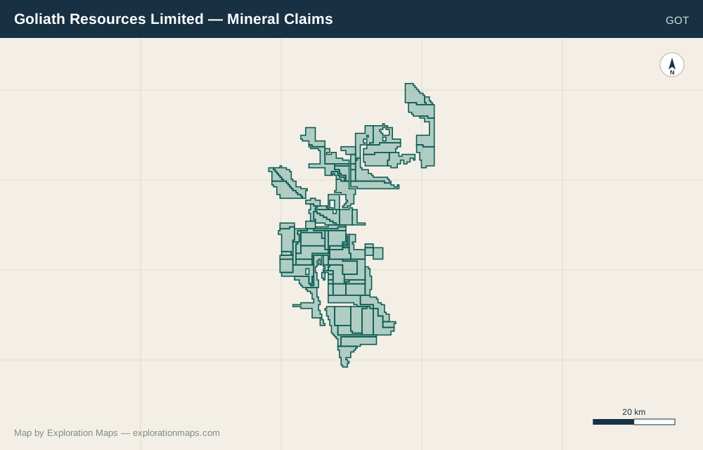
On September 15, 2026, a search for Goliath in the BC registered-owner field returned 94 features under GOLIATH RESOURCES LTD, with no truncation reported. This is a dated search observation, not a permanent claim count or verification of the company’s complete land position.
View the Goliath company-page snapshot or verify individual tenures in Mineral Titles Online. Search results can change as the published record changes. Or browse all mineral claim maps by company.
| Step | What to inspect |
|---|---|
| Search Goliath in British Columbia | Read the registered-owner spelling rather than relying on the ticker GOT. |
| Review GOLIATH RESOURCES LTD | Compare title identifiers and geography with your source records and Mineral Titles Online. |
| Choose the relevant titles | Use Select All only if every returned title belongs in the map you are making. |
| Add the selected claims | Review the map extent and the layer source/date; set its legend name and export layout. |
Choose the right jurisdiction and search field
| Coverage | Name-search scope |
|---|---|
| BC, Ontario, Quebec, Saskatchewan, Newfoundland & Labrador | Registered-owner or holder fields in the configured public dataset. |
| Yukon | Quartz claim owner/name lookup; this workflow does not include placer claims. |
| Manitoba | Claim or tag number only; no holder-name field in the configured layer. |
| United States federal claims | Project/claim-name lookup is not a claimant ownership search. |
When a company name returns nothing
The BC company-search guide explains candidate groups and selection. An empty search does not prove a company has no claims.
- Try the distinctive part of the registered legal name.
- Check known subsidiaries, previous names or joint-venture titleholders against source documents.
- Use a known title number to inspect how the holder is recorded.
- Check the jurisdiction and claim type before interpreting an empty response.
Build a map from the records you have checked
Add selected records as a layer, give it a meaningful legend name and include the source and retrieval date. Use separate layers for separate holders or projects. A public-data match is a research starting point; confirm title details in the official registry before relying on the map.
Read coverage, sources and update timing, or use file upload if you already have a reviewed boundary.
Verify with the official registry: Claim search results and any maps built from them are for research and visualization only. Exploration Maps is not an official government registry. Always verify current claim ownership, status, boundaries, and tenure details through the applicable government mineral titles registry before relying on them for transactions, staking, or filings. Search-by-company-name is available where the underlying public claim data supports it.
Make your first map
Find or upload your claims, choose an investor layout, and download your map.
Create my map →