How to Import GeoJSON Data into a Mining Map
To import GeoJSON into Exploration Maps, click the import button in the Layers section, select your .geojson or .json file, and the layer is added automatically with the map zoomed to your data. Assign a layer Role (Claims, Drillholes, Targets) to get standard exploration styling in one click.
What you need
- A .geojson or .json file (polygons, lines, or points)
- Coordinates in WGS84 latitude/longitude (EPSG:4326) — the standard for web maps
- If your data is a Shapefile or KML: two minutes to convert it (below)
Why GeoJSON is the easiest format to work with
GeoJSON is a single text file that encodes polygons, lines, and points as JSON. Unlike a Shapefile — which is really four or more files that must travel together — a GeoJSON never arrives missing its .prj or .dbf. Most government open-data portals and modern GIS tools export it directly, and it imports into Exploration Maps with zero configuration.
Converting a Shapefile to GeoJSON (free, 2 minutes)
If your data came as a Shapefile (.shp + .dbf + .shx + .prj) or KML, convert it first:
- Go to mapshaper.org (free, runs in your browser — your data never uploads to a server)
- Drag the whole Shapefile set in (or the .zip) — include the .prj so the projection is read correctly
- Click Export → GeoJSON
- Import the downloaded file into Exploration Maps
Importing the file
In Exploration Maps, click the import button in the Layers section of the sidebar and select your file. The layer is added, the map zooms to its bounds, and polygon, line, and point geometry are detected automatically. Attribute properties come along too — they drive labels and callouts later.
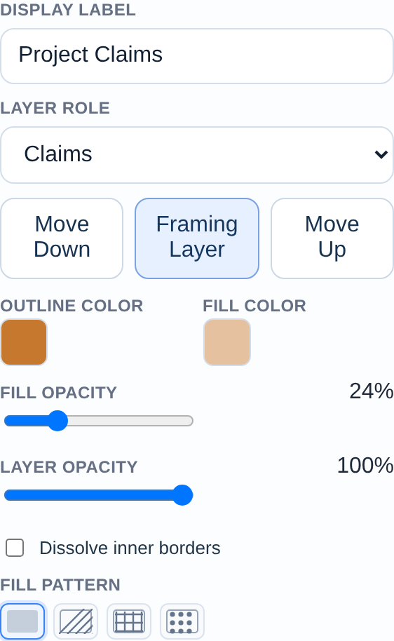
Assign a Role to get instant styling
Expand the new layer card and set its Role. Roles apply the styling conventions readers of exploration maps expect — Claims get the classic boundary treatment, Drillholes render as collar points, Target Areas get dashed outlines. You can override any colour afterwards, but the role gets you to a presentable map immediately.
If your data lands in the wrong place
Exploration Maps expects geographic coordinates (WGS84 / EPSG:4326). If your imported layer appears in the ocean or at (0,0), the file is almost certainly in a projected system like UTM.
-proj wgs84 (or export from your GIS with CRS set to EPSG:4326), then re-import. Zone mismatches are the #1 cause of misplaced exploration data.