How to Search Newfoundland Mineral Licences and Map a Project
To map Newfoundland & Labrador mineral claims (exploration licences), open Exploration Maps, choose Add Claims → Search Claims Registry, select Newfoundland & Labrador, and type a company or licensee name (or a licence number). Add the licences to your map, style them, and export. Always verify current licence holder, status, and boundaries in the official NL GeoAtlas before relying on the map.
How Newfoundland tenure works (licence-based)
Newfoundland and Labrador uses a licence-based system. A Mineral Exploration Licence (MEL) grants exclusive exploration rights within a map-staked area of up to 256 cells of 25 ha each (6,400 ha). Central Newfoundland's Exploits Subzone is in a gold-exploration renaissance, while Labrador hosts iron ore and base-metal deposits including Voisey's Bay. Licences are administered by the NL Department of Industry, Energy and Technology, with public access through the NL GeoAtlas.
Step 1: Open registry search for Newfoundland
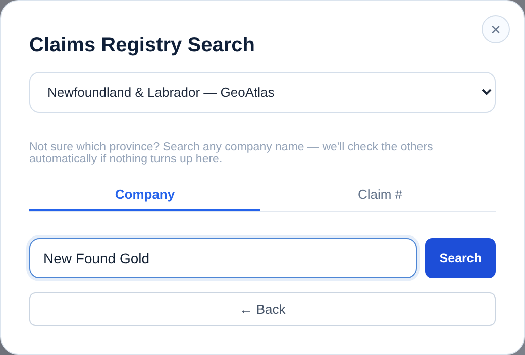
Choose Add Claims → Search Claims Registry and select Newfoundland & Labrador — GeoAtlas. Two tabs are available: Company (licensee name) and Claim # (licence number).
Step 2: Search by licensee or licence number
Type a company or licensee name — e.g. 'New Found Gold' or 'Exploits Discovery' — or switch to Claim # for a specific licence. Results are clustered geographically (Central Newfoundland, Labrador Trough, Northern Peninsula) so you can pick the right project area.
Step 3: Add licences and assign the Claims role
Select the geographic clusters for your project area, review the total hectares and expiry information, and click Add to map. The licence polygons load as a layer; assign the Claims role for investor-standard styling and rename layers if you're showing more than one project.
Step 4: Add context and export a project map
Choose a Terrain or Satellite basemap, enable Reference Labels for communities and features, add your title block and logo, and export PNG for slides or PDF for reports. An inset showing the regional context of the Exploits Subzone or Labrador Trough helps investors place your ground quickly.
Example: a central Newfoundland project map
For a project update in the Exploits Subzone, search your company name, select Newfoundland & Labrador, add your licence cluster, assign the Claims role, switch to Satellite, add a title block with the project name and date plus a small regional inset, and export Landscape 16:9 — a clean project map that reads at a glance in a deck or release.
Verify in NL GeoAtlas
Where the data comes from
What the app can and can't verify
Cannot: confirm legal ownership, good-standing, work commitments, or survey-grade boundaries. Confirm specifics in GeoAtlas.
Related guides
See the broad mining claims map guide, compare with Ontario or Quebec, import your own files with the GeoJSON / Shapefile guide, and finish with the professional map guide.