How to Add a Scale Bar and North Arrow to a Mining Map

Toggle Scale Bar and North Arrow on in the Design section of the sidebar. Both render on the map automatically — the scale bar computes true ground distance for your current view — and each can be assigned to any corner with the corner pickers.
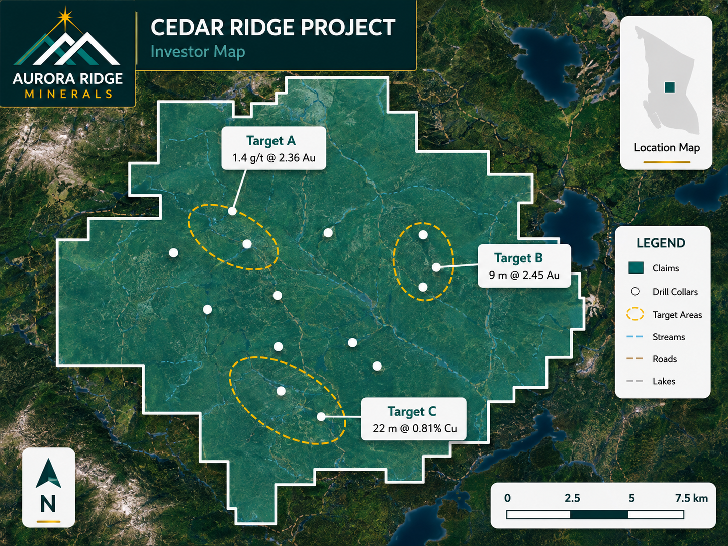
Example mining map created in Exploration Maps
A finished map exported from Exploration Maps — the kind of output this guide walks you to.
Turn public claim data into a clean map. No GIS experience needed — import, style, and export in minutes.
Open Exploration Maps →

Why these two elements are non-negotiable

A map without a scale bar and north arrow isn't a figure — it's an illustration. Reviewers of technical reports expect both on every map figure, and investors subconsciously read their presence as competence. They cost two clicks; missing them costs credibility.

Report figures
Preparing figures for a technical report? See the full checklist in How to Create an NI 43-101 Map Figure.

Enable the scale bar

Open the Design section and toggle Scale Bar on. It calculates real ground distance for the current view and picks a clean round number (1 km, 2 km, 5 km…) that updates as you zoom — you never hand-edit it.

Enable the north arrow

Toggle North Arrow on in the same section. Choose the style that matches the map's tone — the simple arrow suits technical figures; the compass style suits presentation maps.

Position both with the corner pickers

Each element gets a corner assignment. The conventions that keep a figure tidy:

  • Scale bar: bottom-left or bottom-right, away from the legend
  • North arrow: a top corner, opposite the title block
  • Never let either overlap data, labels, or the inset map
  • Elements assigned to the same corner stack automatically with correct spacing
Import your file and export an investor-ready map. Open the editor and have a shareable map in minutes.
Open Exploration Maps →

Frequently Asked Questions

Does the scale bar stay accurate at high latitudes?
Yes — it computes true ground distance at the map centre for the current view rather than assuming a fixed metres-per-pixel, which is exactly where naive scale bars go wrong on northern properties.
Can I set the scale bar to a specific distance like exactly 5 km?
The bar auto-selects a clean round distance appropriate to your zoom. Adjust zoom slightly and it snaps between standard steps (1, 2, 5, 10 km…), so you can land on the figure you want.
Are the scale bar and north arrow included in exports?
Yes, both render into PNG and PDF exports at full resolution, in the corners you assigned.
Do I need both for an NI 43-101 figure?
Standard practice is yes — scale bar, north arrow, legend, and title information are the baseline expectations for technical report figures. Your QP has final say on the report's requirements.